Oh, how differently things look from above. In the plotting of an adventure for an early winter bushwhacking trek, I chose an expanse of undeveloped, public forest in the northern stretches of Itasca County. Aerial imagery showed remnants of logging patches and overgrown paths of various sorts, but certainly little qualified as a trail or a road, save the county road that bisected the sections I had chosen.

From aerial imagery, it seemed like it could be rugged, but a number of faded trails were evident that could be followed for portions of the six-mile trek. Being imagery from a late fall or early spring, the hardwoods were leafless and green made it apparent where the conifers were standing. An entry point chosen off a county road that capped the northern boundary of the terrain would lead down a logging road and fade into the forest where eventually I could emerge again, follow a creek westward on the southern edge of my chosen area, cross the northbound bisecting road, meander through the western half, cross the road back east and find my way back to the starting point. That was the plan. Six miles. Simple enough.
It may have been that we didn’t start the journey in the precise place I had planned, but whatever the case, early into the journey I had only a vague and general sense of where we were. Either way, my friend an I had an adventure.
 In the cool morning the frozen snow crunched under our feet. Though we were loud crunching through the silence of daybreak, the start of the trek was easy going as we followed the frozen ruts of a black powder hunter’s truck along a rough but established trail. Wolf tracks and scat crossed our path periodically. We got into some thick balsam and spruce and jumped some grouse, and all was going according to plan. Eventually, however, the trail faded away, and not where I anticipated it to. I squinted at my grainy black and white print-out of the aerial imagery, but it was an imperfect map. We backtracked a bit, and were then unclear if we had started in the right place. A change of plans.
I knew the creek traced the southern boundary of the land I planned to trek, so provided we headed south, we could eventually get some better bearings again. Perhaps, even intersect up the planned route. We bushwhacked southish through hardwoods, and for a while followed a fresh trail of wolf tracks as it lead in the general direction we were heading. Hardwoods turned to balsams. There was simultaneous too much snow and not enough. If there were more snow, we could have been in snowshoes and easy floated over the terrain. As it was, there was just enough to hide hidden snags and pits, which made each step a gamble.
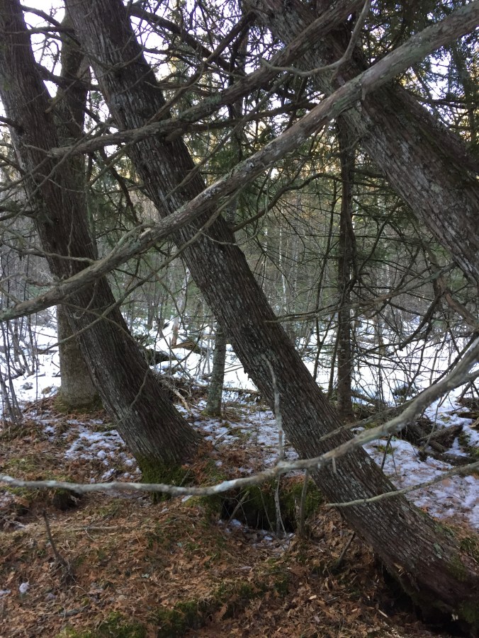
We were already huffing. We came to a stand of leaning cedars and moss-covered knobs. It was the perfect place for a break. And a break wisely taken, for little did we know, the trek was about to get miserably worse. Trudging through a beautiful, but challenging cedar and spruce swamp, the scene eventually brightened up. It brightened up into an endless expanse of alder. Alder. ALDER!
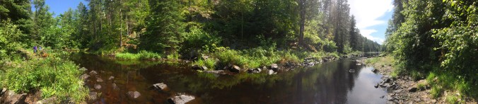
Alder, the scourge of the bushwhacker. What a pain to navigate, especially with only moderate snow cover. These are the things you do not see from a grainy aerial image. From above it looks flat and easy. From the ground it’s a completely different picture. To shorten the story, it was a long and painstaking journey through the alder, until we finally came to the creek. We stopped at a beaver lodge for a break, and then continued along the creek, trying to navigate where the ice was thick enough but the alders were thin enough. Eventually we got to high ground along the creek where monumental spruces towered. We stumbled on some old rusty barrel hoops, a dented and rusted bucket, and other rusted iron from an era past. The should of water rushing over rocks near the remnants of a dam recently removed was needed therapy.
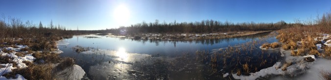
We strayed Northwest on our trek to the road, and passed through an area that had been logged a few years ago. That means a thick stand of sapling poplars, which was like walking through a tight forest of fishing rods. It wasn’t easy. Also from aerial footage, it looked like just a flat gray area, and an easy feat. Once again, experience was much different with boots on the ground versus eyes in the air. We got to the county road, hiked north again and crossed to the other side. We hiked through more young poplar growth shooting up on freshly logged land, and had a pretty easy go of it on a trail. We trudged until the woods thickened and we were in the towering pines. We jumped a number of grouse, but every time I was a little too slow with the sidearm. Eventually we were back into dense, sapling poplars, which was again difficult to pass. That lead to an intimidatingly thick and tall stand of balsam firs, which we bushwhacked until we hit a spruce bog, which opened up to a glasslike frozen beaver pond. We took a break by a lodge, crossed the glass to high ground, and to wrap it up, and a laborsome trek back east across the road and through the woods to where we had begun.
Uffda. We finished the trek and we were exhausted. We couldn’t necessarily say we had fun. We had an adventure… but was it fun? I say adventure is a balance of fun+misery, but this one was leaning a bit heavy on the misery side. In the end one thing was clear: your goals look very different on the ground than they do when planning them from the air.
 End of October in northern Minnesota, I should have expected as much, but the fall turned to winter quickly. My shelter was frumpy, and I orientated it with the view of the lake in mind… more than the prospect of wind coming off the lake in mind. I’m still a little wet behind the ears when it comes to bushcraft, and lacking some of the right gear to do it well; but a terribly constructed and planned shelter compounded by falling damp temperatures made for a pretty restless night. In the midst of rut, I was also kept on edge by the sounds of enamored deer chasing each other through the woods. Even though I’m ‘all grown up’ and was 95% sure the noises I was hearing were just deer, my imagination was still going wild as I slept alone in the woods with noises of creatures breaking through the darkness. For comfort and security, I kept my side arm close at hand. Just in case the bears weren’t hibernating yet, the wolves smelled steak on my hands, or Leather Face was out on the hunt.
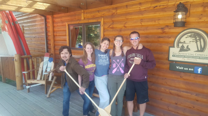 Five of us took two canoes into the BWCA at the beginning of August. Mudro is a vicious entry… mountain goat path portages interrupted by piddly short paddles before having to portage again. After the initial hurdles are conquered, however, it opens up into bigger, beautiful water.